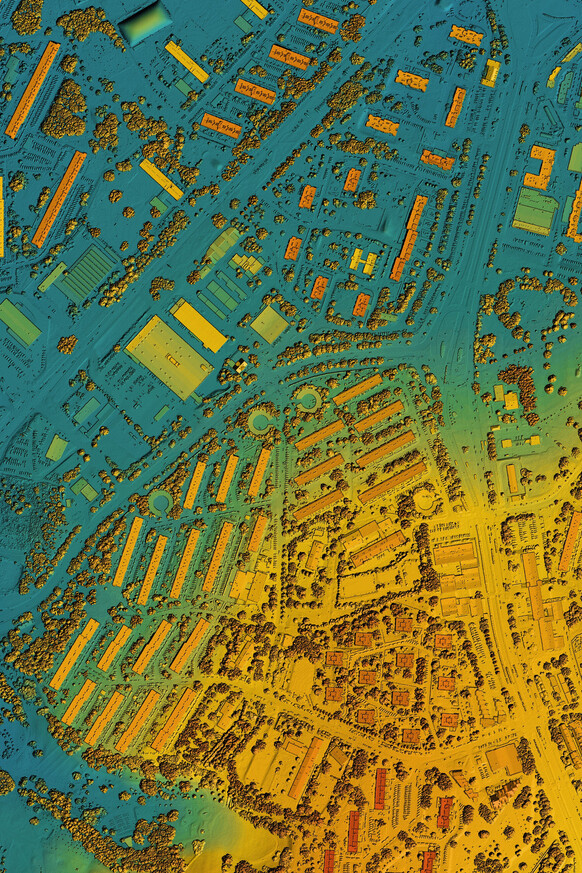
Comprehensive Data Collection
Our GIS team specializes in meticulously collecting comprehensive spatial data, forming the accurate foundation for your projects. We use cutting-edge technology combined with traditional surveying techniques to capture precise information on existing infrastructure, with a focus on both above-ground and hidden underground materials, including utility networks, property boundaries, topographical features, and environmental elements.
Our thorough approach ensures that your GIS database is populated with reliable, high-fidelity data. The result is a complete and accurate digital representation of your assets and surrounding environment for effective management and planning.
Data Cleansing & Seamless Integration
Optimizing Your Geospatial Data
We ensure the quality and usability of your geospatial data through rigorous cleansing and seamless migration. Our process corrects inconsistencies, resolves errors, and integrates diverse datasets into a unified, accurate GIS platform, preparing it for optimal performance.
Interactive GIS Solutions
We design custom web maps, intuitive applications, and efficient geospatial surveys tailored to your specific needs, providing accessible and actionable spatial intelligence.
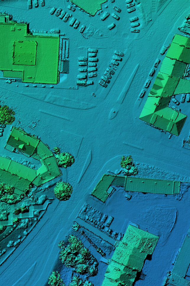
Precise Infrastructure Mapping
Creating highly accurate digital maps of all your assets, including critical underground utilities.
Enhanced Decision-Making Capabilities
Providing clear spatial insights that empower informed strategic planning and resource allocation.
Intuitive Asset Management Tools
Developing user-friendly interfaces for efficient visualization, tracking, and management of infrastructure assets.
Affordable Utility Mapping Solution
Specializing in cost-effective GIS applications for comprehensive and accessible utility data management.
Empowering Your Team
Seamless Integration & User Adoption
We guide communities through the entire implementation process, providing comprehensive GIS startup services. Beyond setup, our team offers tailored training programs, empowering your staff, including GIS managers, to confidently use and leverage your new system. Our goal is to ensure seamless user adoption, maximize the benefits of your investment, and foster long-term self-sufficiency.